ANNOUNCEMENTS


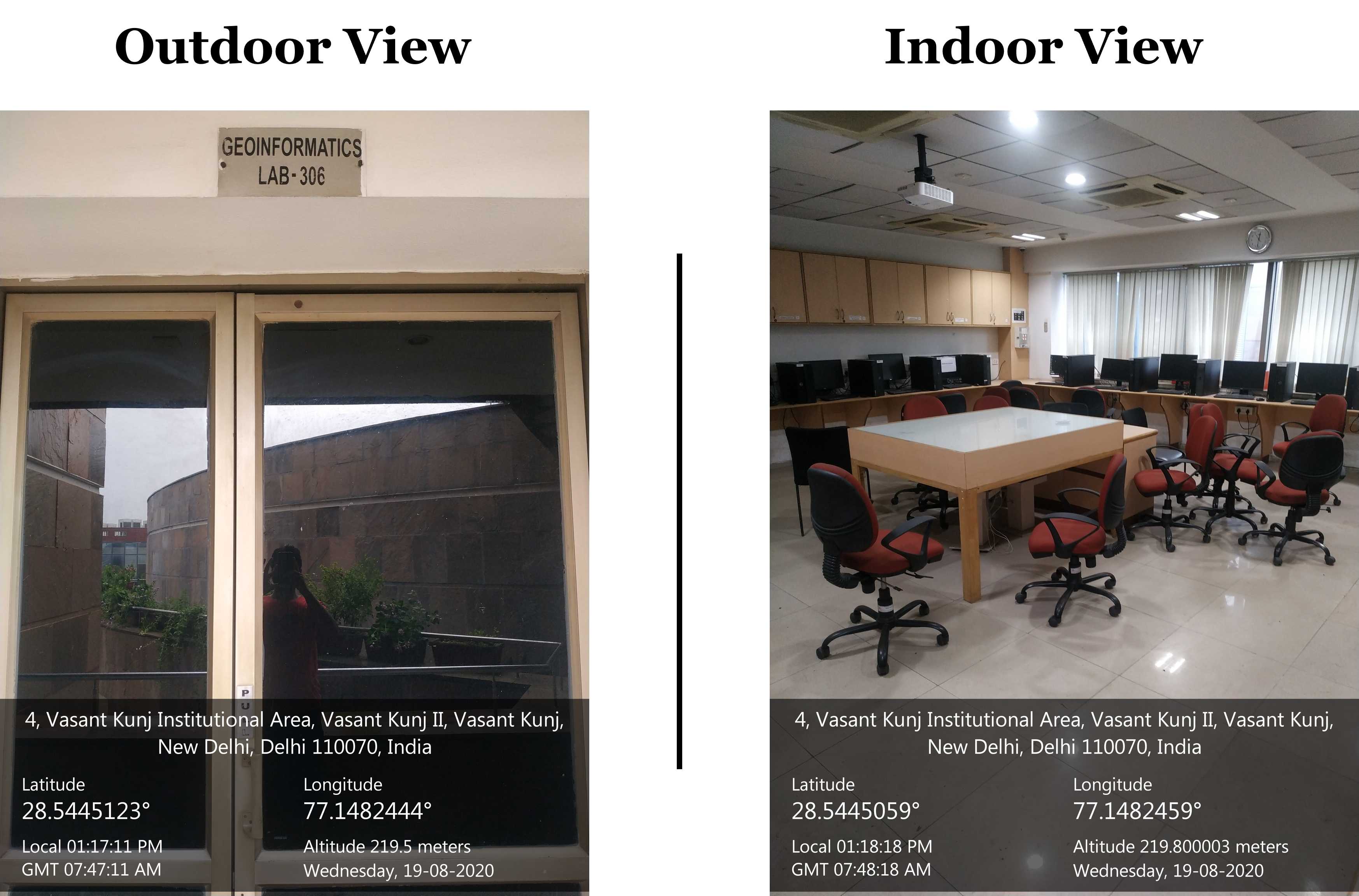
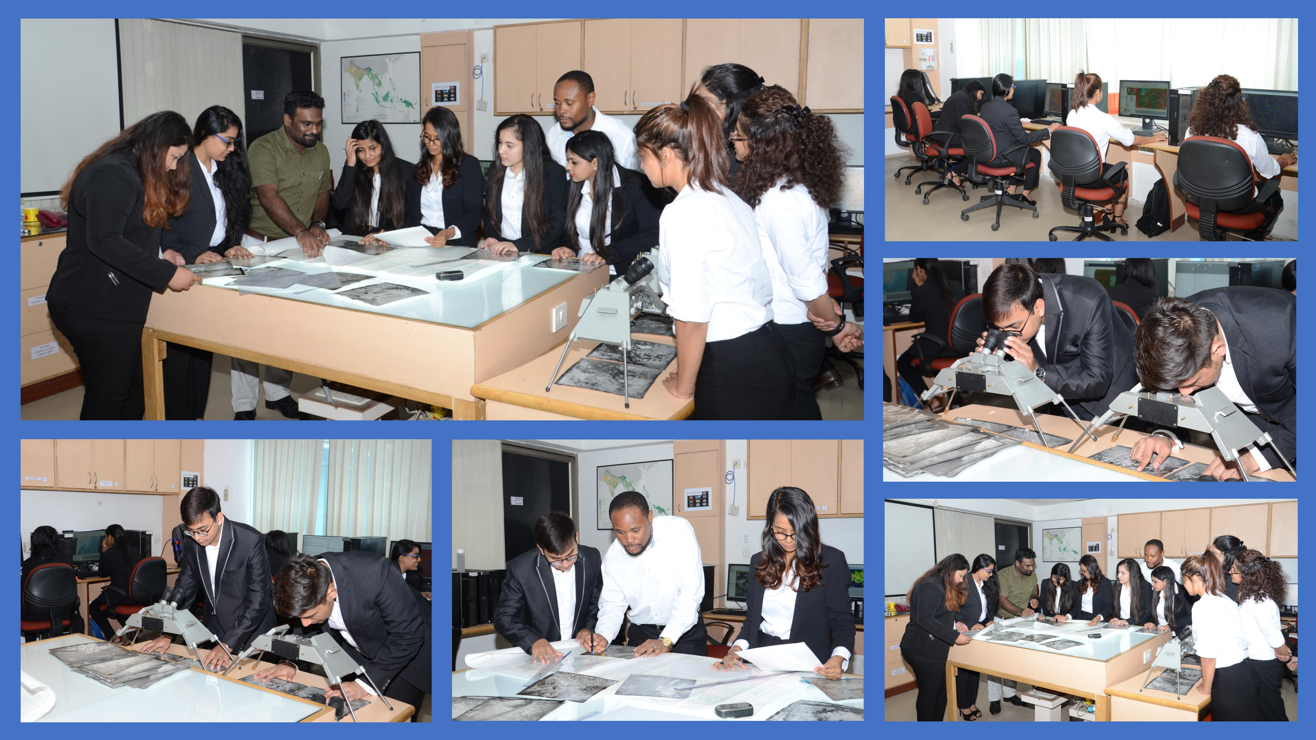
The TERI SAS geoinformatics laboratory is well equipped with state-of-the-art equipment such as state-of-the-art computers (workstations), navigation devices, infrared thermometers, etc. It has licensees to high-end commercial software like ERDAS Imagine, LPS, ArcGIS, MIKE and WEAP along with other advanced support system's mechanism. The laboratory is also equipped with web publishing tools like ArcGIS Advance and ArcIMS Servers. The laboratory is also fitted with various open-source geospatial software’s, to expose our students to the powerful open-source environment.
The laboratory holds a good repository of geospatial information in both digital and hard formats. The Geoinformatics laboratory of the Natural Resources Department of TERI SAS has a solid network with several research establishments and Universities working in Geoinformatics and other associated fields both within and outside the country. We also support R&D activities of various centres of The Energy Resources Institute (TERI) branches located across the country.

• M.Sc. Geoinformatics
• M.Sc. Environmental Studies and Resource Management
• M.Sc. Climate Science and Policy
• M.Sc. Water Science and Governance
• MTech Urban Development Management
• M. Tech Water Resources Engineering and Management
• PhD programme in the Department of Natural Resources
NRG176 - Principles of GIS & GNSS
NRG178 - Principles of remote sensing
NRG106 - Fundamentals of computers and programming
NRG171 - Principles of cartography
NRG 170 - Photogrammetry
NRG 163 - Spatial data modelling and GIS applications
NRG 172 - Digital image processing and information extraction
NRG 108 - Programming in Geoinformatics
NRG179 - Advances in GIS and current trends
NRG181 -Advances in remote sensing: Thermal, Hyperspectral, Microwave, LIDAR, and UAV
NRG 164-Applications of geoinformatics for land resources
NRG165 - Applications of geoinformatics for water resources
NRG166 - Applications of geoinformatics for atmosphere
NRG167 - Geocomputation
NRG 107- Minor Project
NRG 104 - Major Project
NRE175 - Geoinformatics for resource management
WSW172 -Introduction to Geoinformatics / Geo-informatics for water resources
MEU175 - Introduction to GIS
NRE 172 - Principle of Geoinformatics
MEU 172 - Geoinformatics for Urban Development
WSW 178 - Applied geo-informatics for water resources
ERDAS IMAGINE 2018 (commercial software – widely used for remote sensing image processing and photogrammetry)
Rules and instructions for students using geoinformatics laboratory
Remote sensing, GIS, GNSS, applications of geoinformatics in land, water and atmospheres and other related fields.
• Kumar, A. and Singh, C. K. (2015) ‘Characterization of Hydrogeochemical Processes and Fluoride Enrichment in Groundwater of South-Western Punjab’, Water Quality, Exposure and Health 2015 7:3, 7(3), pp. 373–387. doi: 10.1007/S12403-015-0157-7.
• Sam, L., Bhardwaj, A., Sinha, V. S. P., et al. (2016) ‘Use of Geospatial Tools to Prioritize Zones of Hydro-Energy Potential in Glaciated Himalayan Terrain’, Journal of the Indian Society of Remote Sensing 2016 44:3, 44(3), pp. 409–420. doi: 10.1007/S12524-015-0520-Y.
• Kumari, M. Singh C.K., Bakimchandra O., Basistha A. et al. (2016) ‘DEM-based delineation for improving geostatistical interpolation of rainfall in mountainous region of Central Himalayas, India’, Theoretical and Applied Climatology 2016 130:1, 130(1), pp. 51–58. doi: 10.1007/S00704-016-1866-Y.
• Prerna, R. and Singh, C. K. (2016) ‘Evaluation of LiDAR and image segmentation based classification techniques for automatic building footprint extraction for a segment of Atlantic County, New Jersey’, http://dx.doi.org/10.1080/10106049.2015.1076060, 31(6), pp. 694–713. doi: 10.1080/10106049.2015.1076060.
• P Kumar, A Kumar, CK Singh, C Saraswat, R Avtar, AL Ramanathan and Srikantha Herath. (2016). ‘Hydrogeochemical Evolution and Appraisal of Groundwater Quality in Panna District, Central India’ Exposure and Health.
• Mehra M, Oinam B, Singh CK. (2016). ‘Integrated Assessment of groundwater for agriculture use in Mewat District of Haryana, India using Geographical Information System (GIS)’ Journal of the Indian Society of Remote Sensing
• Prashant H. Pandit, Nithiyanandam.Y (2017) ‘Drought Monitoring Using Open Source Remote Sensing Datasets’, in The 38th Asian conference on remote sensing, 23-27 October. ISRO, New Delhi,India: Asian association of remote sensing, Indian remote sensing society and international society for photogrammetry and remote sensing.
• Nithiyanandam Yogeswaran, Sayona S Jacob, V. S. (2017) ‘Temporal Analysis of Summer-Time Urban Heat Island Intensity Over Five Metropolitan Cities in India’, in The 38th Asian conference on remote sensing, 23-27 October. ISRO New Delhi,India: Asian association of remote sensing, Indian remote sensing society and international society for photogrammetry and remote sensing.
• Arun Murali C.M, A. C. and N. Y. (2017) ‘A pilot study on prediction of heat wave events over the coastal area of India using Sea Surface Temperature’, in The 38th Asian conference on remote sensing, 23-27 October. ISRO New Delhi,India: Asian association of remote sensing, Indian remote sensing society and international society for photogrammetry and remote sensing.
• Aakanksha, Vinay Hudda, N. Y. (2017) ‘An Aseessment of heat impacts on health using thermal zobatuib Techniques’, in The 38th Asian conference on remote sensing, 23-27 October2. ISRO, New Delhi,India: Asian association of remote sensing, Indian remote sensing society and international society for photogrammetry and remote sensing.
• Mehra, M,Singh C.K., Abrol I.P., Oinam B. et al. (2017) ‘A GIS-based methodological framework to characterize the Resource Management Domain (RMD): A case study of Mewat district, Haryana, India’, Land Use Policy, 60, pp. 90–100. doi: 10.1016/J.LANDUSEPOL.2016.10.018.
• Kumari, M., Singh, C. K. and Basistha, A. (2017) ‘Clustering Data and Incorporating Topographical Variables for Improving Spatial Interpolation of Rainfall in Mountainous Region’, Water Resources Management 2016 31:1, 31(1), pp. 425–442. doi: 10.1007/S11269-016-1534-0.
• Singh, C. K. et al. (2017) ‘Multivariate statistical analysis and geochemical modeling for geochemical assessment of groundwater of Delhi, India’, Journal of Geochemical Exploration, 175, pp. 59–71. doi: 10.1016/J.GEXPLO.2017.01.001.
• Kumari, M., Singh, C. K., Basistha, A., et al. (2017) ‘Non-stationary modelling framework for rainfall interpolation in complex terrain’, International Journal of Climatology, 37(11), pp. 4171–4185. doi: 10.1002/joc.5057.
• Pommier, M., Hilde Fagerli, Michael Gauss, David Simpson, Sumit Sharma, Vinay Sinha, Sachin D. Ghude, Oskar Landgren, Agnes Nyiri, and Peter Wind et al. (2018) ‘Impact of regional climate change and future emission scenarios on surface O3 and PM2.5 over India’, Atmospheric Chemistry and Physics, 18(1), pp. 103–127. doi: 10.5194/ACP-18-103-2018.
• Singh, P. Vinay Shankar Prasad Sinha, Ayushi Vijhani and Neha Pahuja et al. (2018) ‘Vulnerability assessment of urban road network from urban flood’, International Journal of Disaster Risk Reduction, 28, pp. 237–250. doi: 10.1016/J.IJDRR.2018.03.017.
• Demir, N. and Yogeswaran, N. (2018) ‘Semi-automated cemetery mapping using smartphones’, International Archives of the Photogrammetry, Remote Sensing and Spatial Information Sciences - ISPRS Archives, 42(5), pp. 59–62. doi: 10.5194/ISPRS-ARCHIVES-XLII-5-59-2018.
• Nithiyananda Yogeswaran and Lakshmi P . (2018) ‘Applying Geospatial Techniques for Mapping Coastal Resources of Mahatma Gandhi Marine National Park of Andaman and Nicobar Islands’ - The Indian Geogrpahical Journal.
• Sinha, V. S. et al. (2019) ‘Mitigating extreme weather events through wetland conservation.’, in Pradip Sharma, Jaideep Baruah, Dhanjit Deka, P. K. (eds) (ed.) Harnessing Wetlands for Sustainable Livelihood. Chennai: Notion Press, pp. 15–25.
• Ghosh, M., A, S. M. and Karmakar, S. (2019) ‘Flood Risk Assessment under Various Socio-economic Scenario’, in ISH-HYDRO 2019 International Conference. Osmania University, Hyderabad,India.
• Chaudhuri, R. R., A., S. M. and Tarannum, F. (2019) ‘Waterscapes through Multi-stakeholder Approach for a Water-stress region in Delhi NCR, India’, in ISH-HYDRO 2019 International Conference. Osmania University, Hyderabad,India.
• Sherly, M. A., Janadri, K. K. and Karmakar, S. (2019) ‘Fuzzy cognitive mapping of flood risk perception and adaptive capacity of slum communities over the most flood-prone city in India’, in 4th IMA International conference on Flood Risk (IMA 2019). Swansea University, UK.
• Singh, N, Neeti, N (2019) ‘International Conference on Climate Change Impacts, Vulnerabilities, and Adaptation: Emphasis on India and Neighborhood, IIT Kharagpur’.
• Jain, D. and Tiwari, G. (2019b) ‘Measuring density and diversity to model travel behavior in Indian context’, Land Use Policy, 88, p. 104199. doi: 10.1016/j.landusepol.2019.104199.
• Machineni, N. Vinay S.P.Sinha, Prasoon Singh, N.T.Reddycet al. (2019) ‘The impact of distributed landuse information in hydrodynamic model application in storm surge inundation’, Estuarine, Coastal and Shelf Science, 231, p. 106466. doi: 10.1016/J.ECSS.2019.106466.
• Singh, R. K., Sinha, V. S. P., et al. (2020b) ‘Modelling Agriculture, Forestry and Other Land Use (AFOLU) in response to climate change scenarios for the SAARC nations’, Environmental Monitoring and Assessment 2020 192:4, 192(4), pp. 1–18. doi: 10.1007/S10661-020-8144-2.
• Singh, R. K., Sinha, V. S. P., et al. (2020a) ‘A multinomial logistic model-based land use and land cover classification for the South Asian Association for Regional Cooperation nations using Moderate Resolution Imaging Spectroradiometer product’, Environment, Development and Sustainability 2020 23:4, 23(4), pp. 6106–6127. doi: 10.1007/S10668-020-00864-1.
• Tuzta?, Neslihan, Nithiyanandam Yogeswaran (2020) ‘Detection of Flooded Areas with Radar Image Analysis’, in 8th International Conference on Cartography and GIS. Nessebar, Bulgaria.
• Mudita Upadhyay, Sherly M. A. (2020) ‘Integrated Drought Vulnerability Index and Classification using Principal Component Analysis and Cluster Analysis – A Case study of India’
• Mudita Upadhyay, Sherly M. A. (2020) ‘Analysis of large dam storage capacity and its effect on water demand management in India’.
• Mudita Upadhyay, Sherly M. A. (2020) ‘Drought Vulnerability Assessment of India Using Meteorological, Agricultural and Socioeconomic Indicators’.
• Jain, D. and Singh, S. (2021) ‘Adaptation of trips by metro rail users at two stations in extreme weather conditions: Delhi’, Urban Climate, 36, p. 100766. doi: 10.1016/J.UCLIM.2020.100766.
• Jain, D. et al. (2021) ‘Mainstreaming built environment for air pollution management plan in Delhi’, Economic and Political Weekly, pp. 19–22. Available at: https://www.epw.in/journal/2021/6/commentary/mainstreaming-built-environment-air-pollution.html (Accessed: 15 July 2021).
Remote sensing, GIS, GNSS, applications of geoinformatics in land, water and atmospheres and other related fields.
Geo-Informatics lab, Room No C-309, TERI School of Advanced Studies, New Delhi – 110 070.
Email: geoinformatics_lab@terisas.ac.in
Phone number: 011-7180 0222 Ext: 4851
Plot No. 10, Institutional Area, Vasant Kunj, New Delhi - 110 070, India.
Tel. +91 11 71800222 (25 lines).
Website : www.terisas.ac.in
Email id : registrar@terisas.ac.in
© Copyright © 2025, TERI SAS, All rights reserved.
Visitors No.: 46775857 Since 2023


